Skip to content

WATERSHEDS

LITTLE FORK RIVER WATERSHED

The Little Fork River watershed is 1,179,520 acres, the main stem flowing 160 miles through north central St. Louis County and heading northwest into Koochiching County. It flows more northerly until it reaches its confluence with the Rainy River about 11 miles west of International Falls. There are no large cities in this remote watershed. Cook’s population is 667 and Little Fork, 874.

MINNESOTA POLLUTION CONTROL AGENCY (MPCA) REPORTS

MN DEPARTMENT OF NATURAL RESOURCES WATERSHED HEALTH ASSESSMENT FRAMEWORK

Since 2013, the Itasca, North St. Louis, and Koochiching Soil & Water Conservation Districts (SWCDs) have been partnering with the Minnesota Pollution Control Agency (MPCA) to work with local officials and citizens to ensure the health of the Little Fork River Watershed. The map above shows the findings of the Monitoring and Asssessment Report, where red is "impaired" and green is marked for protection sites (not yet impaired, but close).
DNR State Water Trail Guide to the Little Fork River

NATURAL RESOURCES CONSERVATION SERVICE (NRCS) REPORTS

SUMMARY OF MONITORING AND ASSESSMENT IN THE LITTLE FORK RIVER WATERSHED

Intensive watershed monitoring began in the Little Fork River watershed in 2008. Local citizens, collaborating with Soil and Water Conservation Districts of North St. Louis, Itasca and Koochiching Counties, Little Fork/Rat Root River Board and the state’s Department of Natural Resources and Pollution Control Agency are working to improve and protect its waters. Limited land uses for industry, housing, and roads have led to high water quality in the Big Fork system, however challenges remain in maintaining this high quality water.

Of the 43 stream reaches that were assessed, 37 were found to be fully supporting of aquatic life while six were non-supporting of aquatic life. Twelve (12) stream reaches were assessed for aquatic recreation and all were fully supporting. All 15 assessed lakes were also fully supporting of aquatic recreation. Aquatic consumption impairments span the entire length of the Little Fork and Sturgeon Rivers due to excess levels of mercury. The single aquatic life biological impairment was found on the Rice River, while the remaining aquatic life impairments were turbidity driven and located along the Little Fork River.

Overall, the results from the intensive watershed monitoring and holistic assessment process reveals that the Little Fork River Watershed remains as one of Minnesota’s most treasured resources. The vast tracts of forests and wetlands throughout the watershed, along with limited development pressure, have helped to sustain a high quality aquatic resource. However, non-point source pollution that contributes to the excess levels of turbidity found throughout the Little Fork River continues to impact the quality of its surface waters and to downstream waters as well.


ADDRESSING SEDIMENT THROUGH FINGERPRINTING

This project is being led by the United States Geological Survey (USGS) and the Minnesota Pollution Control Agency (MPCA) with support from the Koochiching SWCD and North St. Louis SWCD to address a 105-mile stretch of the river that is impaired for turbidity (suspended soil particles in water).  While it has been established that there is an excess of sediment present in the Little Fork River, it’s been unknown how to proceed in reducing it to acceptable levels. Identifying sediment sources is the first step in targeting sediment-laden stream reaches for projects.

What is Sediment Fingerprinting?

The sediment fingerprinting process is an analysis of sediment that can attribute the particles’ source to different locations in the watershed. The procedure establishes a set of physical and/or chemical properties (tracers) based on samples collected in upland or channel locations identified as potential sources of sediment. These properties are unique for each location within the watershed. Fluvial sediment samples (sediment transferred by a river system) exhibit a composite, or “fingerprint” of source properties. Through statistical procedures, the target sediment properties can be matched to their respective upland or channel source “fingerprints”.  Determining the sources (erosion sites) and sinks (deposit locations) of sediment is important in developing strategies to reduce sediment loads to water bodies impaired by turbidity.

Progress in 2021

Sediment sampling occurred throughout the watershed in 2021 and will continue into 2022 to distinguish the origin of sediment in the Little Fork River. Staff from all four organizations will be collecting samples starting at ice out 2022 and continuing throughout the summer.

2021 sampling yielded 163 samples consisting of upland, in-stream, and event-based samples throughout the watershed. This collection occurred on county, state, federal, and private lands and will be analyzed this winter and spring. The event-based samples (those having to do with run-off and rain events) will be collected in the spring and summer of 2022 due to drought conditions throughout the watershed this past summer. This requires a 1-inch rainfall event that influences the flow of the rivers substantially. Koochiching SWCD staff is excited to partner with USGS, MPCA, North St. Louis SWCD, and Itasca SWCD to complete the sampling work this coming summer.

Click on the link below for more information.

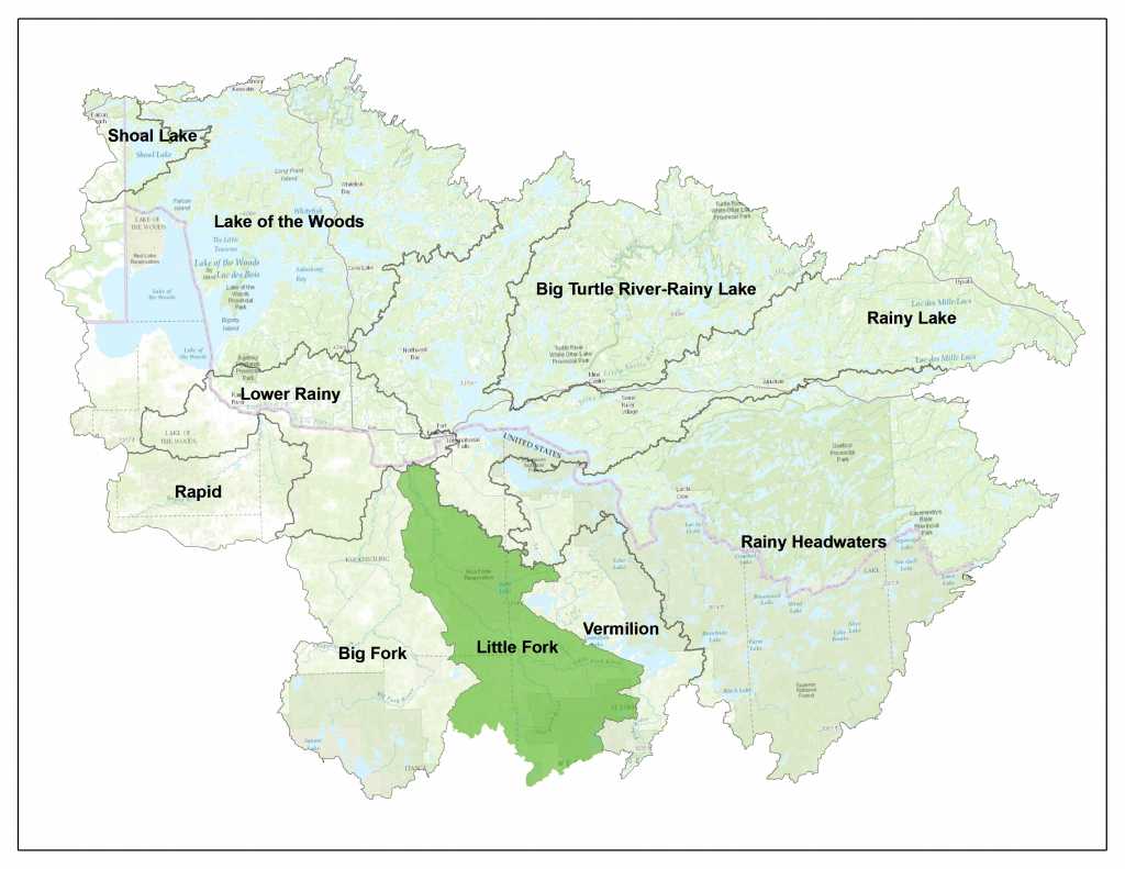
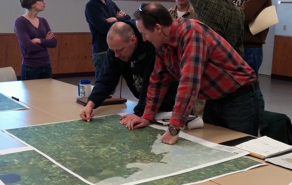
Public Civic Engagement events began in 2013 in the Little Fork River Watershed.  Various types of events were offered to allow the public as many opportunities as possible to obtain information on the WRAPS process and to provide valuable local feedback which was used in the final plans for upcoming restoration and protection projects.

Civic engagement is not packaged into specific years, but is an ongoing process.  To provide comment at ANY time, please see the contacts section of this page to connect with local staff who can offer assistance.


CHECK BACK SOON FOR PREVIOUS CIVIC ENGAGEMENT EVENT INFORMATION!


JOLEN SIMON

Program Coordinator
218-283-1180
jolen.simon@co.koochiching.mn.us

MATT GUTZMANN

Water Resources Specialist
218-999-4435
matt.gutzmann@itascaswcd.org

PHIL NORVITCH

Resource Conservationist
218-471-7287
phil@nslswcd.org

MIKE KENNEDY

Project Manager
218-302-6629
mike.kennedy@state.mn.us