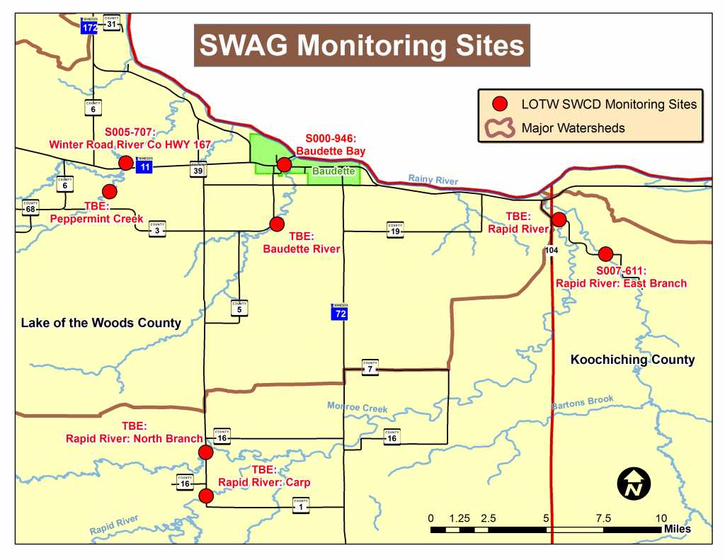
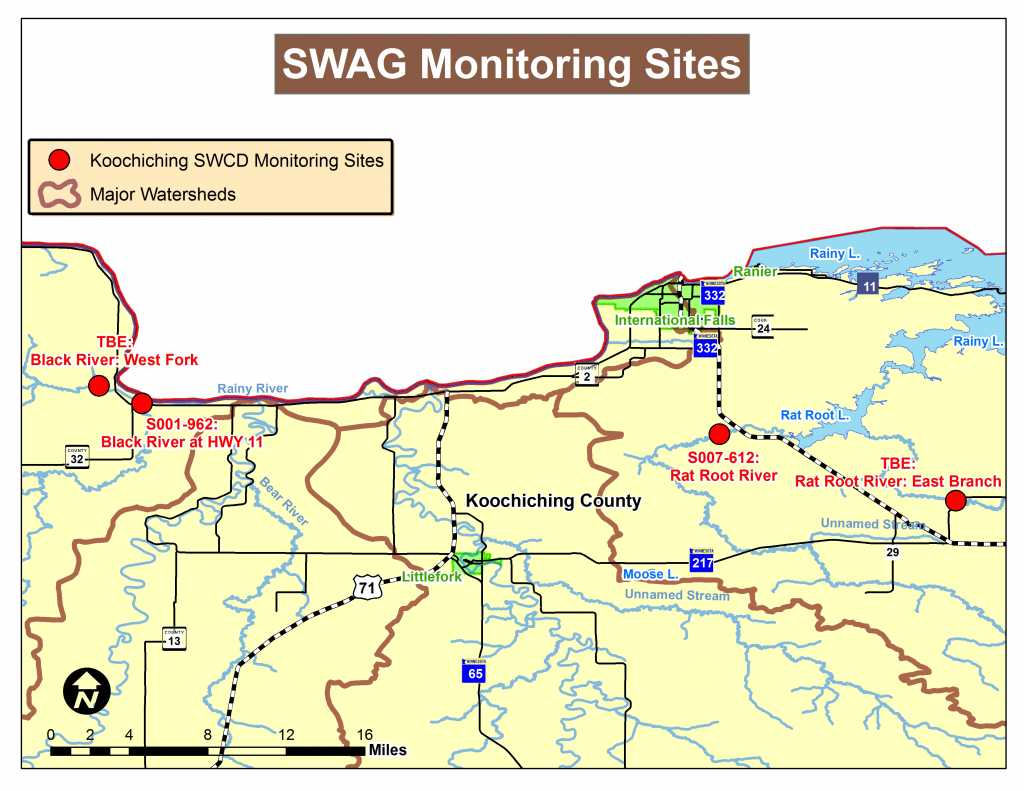
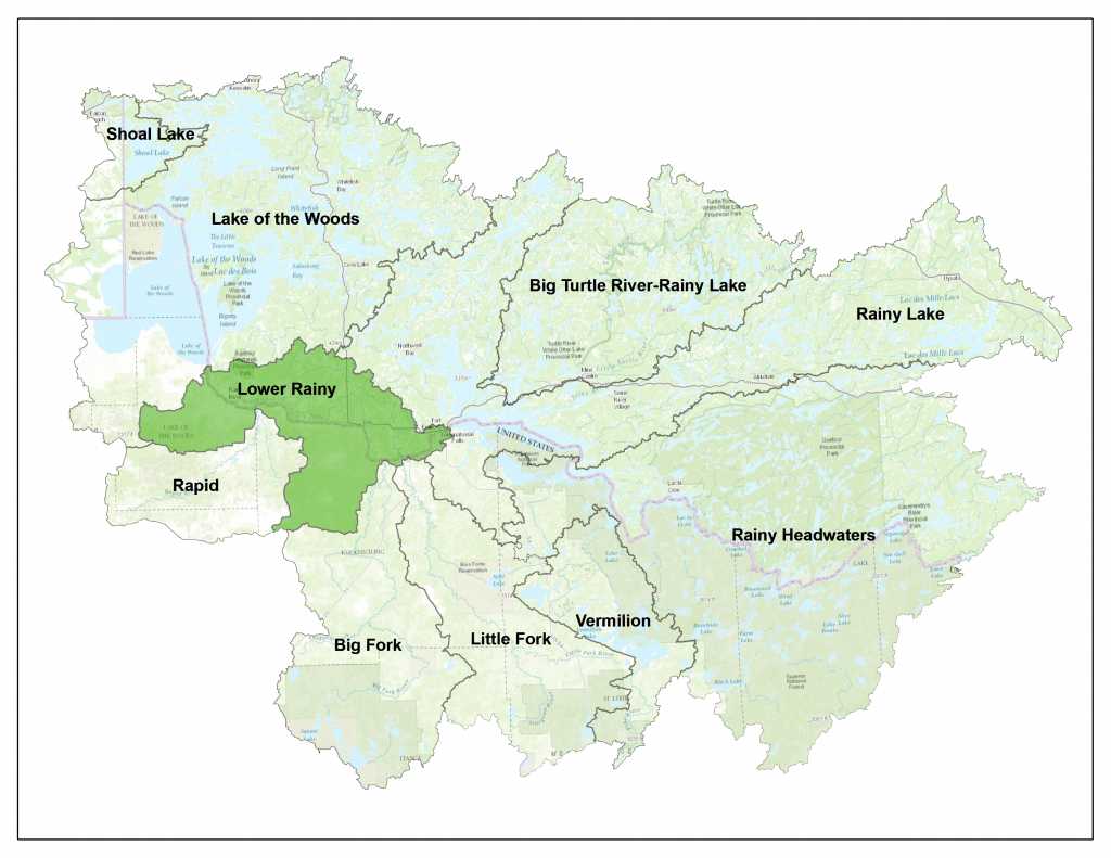
Skip to content

WATERSHEDS

LOWER RAINY RIVER/BAUDETTE WATERSHED

The Lower Rainy River/Baudette watershed lies on the United States-Canadian border, and covers 195,153 acres. The watershed is situated in the Laurentian Mixed Forest Ecological Province of Northern Minnesota. The Lower Rainy River/Baudette watershed is characterized by extensive wetlands located on the Glacial Lake Agassiz lake bed.

The greater Rainy River Basin is home to some of Minnesota’s finest forest and water resources. Voyageurs National Park and the Boundary Waters Canoe Area Wilderness (BWCA) are located within the basin.

LOWER RAINY RIVER/BAUDETTE NEWS & EVENTS

PUBLIC COMMENT PERIOD NOW OPEN

April 4 – May 4 2022


Public Meeting on 4/11/2022


MINNESOTA POLLUTION CONTROL AGENCY (MPCA) REPORTS

MN DEPARTMENT OF NATURAL RESOURCES WATERSHED HEALTH ASSESSMENT FRAMEWORK

NATURAL RESOURCES CONSERVATION SERVICE (NRCS) REPORTS

NRCS defines MPCA’s Lower Rainy River/Baudette as two separate watersheds.  Below are the “Upper” and “Lower” which combined create the full “Lower Rainy River/Baudette” Watershed as defined by this website.

SUMMARY OF MONITORING AND ASSESSMENT IN THE BIG FORK RIVER WATERSHED

Intensive watershed monitoring begins in the Lower Rainy River/Baudette Watershed in 2017 and will continue through October 2018. The Koochiching SWCD has partnered with MPCA and the Lake of the Woods Soil & Water Conservation District to conduct a Surface Water Assessment Grant (SWAG) over 2017-2018.

WATERSHED POLLUTANT LOAD NETWORK (WPLMN)

The sites shown will be sampled between 2017-2018.

The Watershed Pollutant Load Monitoring Network (WPLMN) measures and compares data on pollutant loads from Minnesota’s rivers and streams and tracks water quality trends. WPLMN data will be used to assist with assessing impaired waters, watershed modeling, determining pollutant source contributions, developing watershed and water quality reports, and measuring the effectiveness of water quality restoration efforts.

This long-term program utilizes state and federal agencies, Metropolitan Council Environmental Services, state universities, and local partners to collect data on water quality and flow to calculate pollutant loads.

Public Civic Engagement events are began spring/summer of 2017 in the Lower Rainy River/Baudette Watershed.  Various types of events will be offered to allow the public as many opportunities as possible to obtain information on the WRAPS process and to provide valuable local feedback which was used in the final plans for upcoming restoration and protection.

The first Rapid River Watershed event was an open house event on May 18, 2017 in Baudette, MN regarding monitoring to be done over the 2017-2018 open water seasons.  Fore more information regarding this event, please see the contact section of this page.

Civic engagement is not packaged into specific years, but is an ongoing process.  To provide comment at ANY time, please see the contacts section of this page to connect with local staff who can offer assistance.


CHECK BACK SOON FOR FUTURE CIVIC ENGAGEMENT EVENT INFORMATION!

JOLEN SIMON

Program Coordinator
218-283-1180
jolen.simon@co.koochiching.mn.us

MIKE HIRST

Resource Technician
218-634-1842 ext. 4
mike.hirst@mn.nacdnet.net

CARY HERNANDEZ

Pollution Control Specialist, Sr.
218-846-8124
cary.hernandez@state.mn.us