UPPER/LOWER RED LAKE WATERSHED
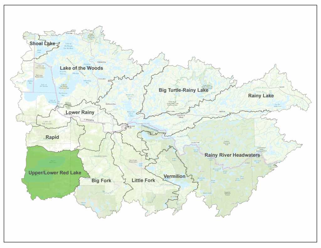
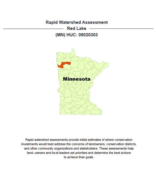
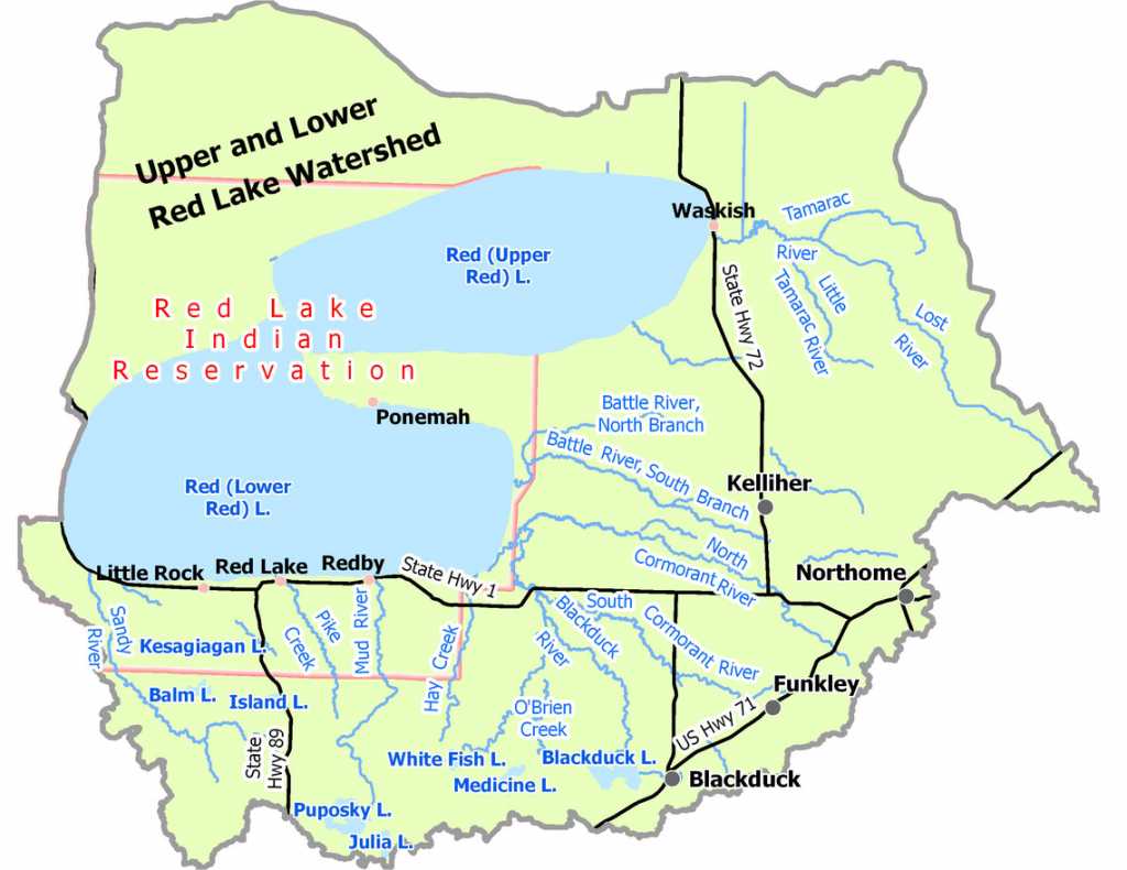
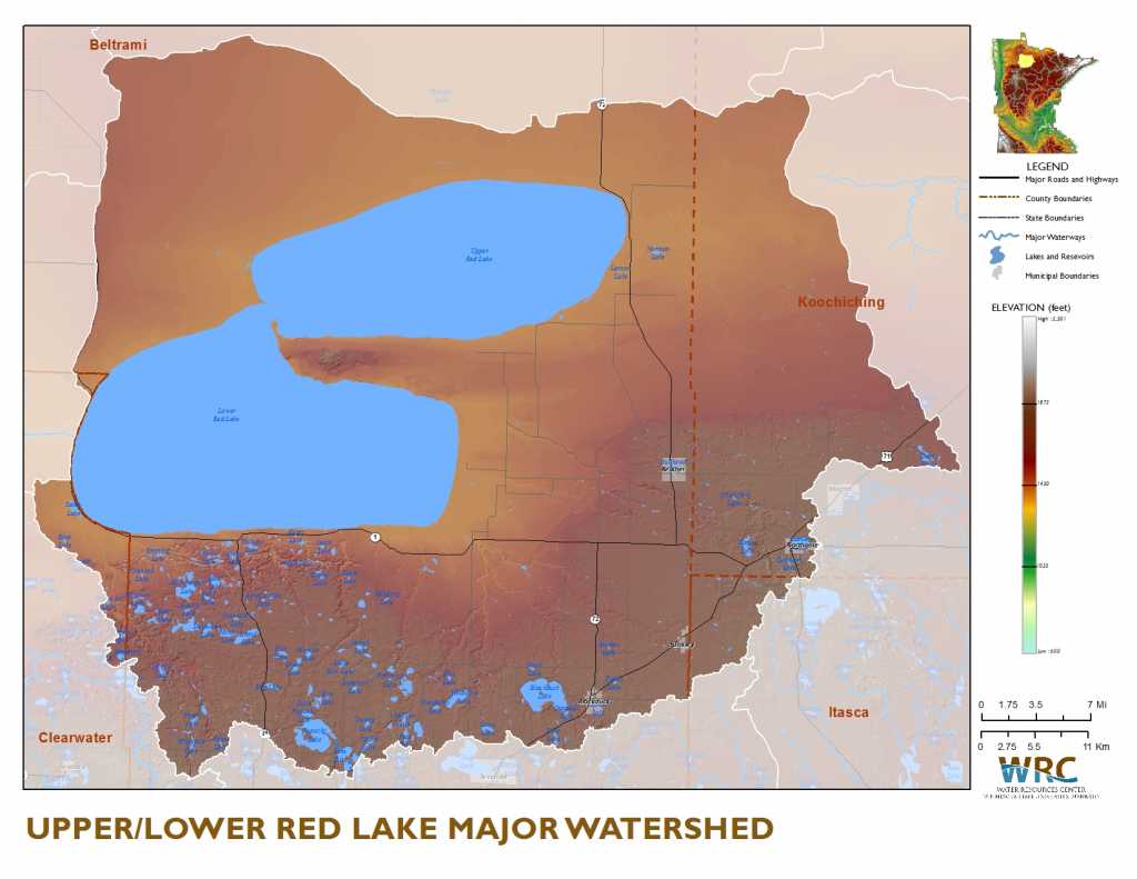
The Upper/Lower Red Lake watershed covers 1,263,678 acres. Located in Minnesota’s Northern Wetlands and Northern Lakes and Forest Ecoregions and a portion of the Red River Valley Ecoregion, this watershed is home to Upper and Lower Red Lakes, the two largest bodies of water within the state. The watershed is by both flow volume and surface area the largest drainage basin of the Red River. Shotley Brook and the Tamarac River are the most prominent tributaries that flow directly into Upper Red Lake. Significant tributaries that flow directly into Lower Red Lake (from west to east) include the Sandy River, Pike Creek, Mud River, Hay Creek, Blackduck River, and Battle River.”
- News & Events
- Reports & Maps
- Monitoring
- Civic Engagement
- Contacts
UPPER/LOWER RED LAKE NEWS & EVENTS
CHECK BACK FOR CURRENT NEWS!
This page will be updated as further events are available.
MINNESOTA POLLUTION CONTROL AGENCY (MPCA) REPORTS
MN DEPARTMENT OF NATURAL RESOURCES WATERSHED HEALTH ASSESSMENT FRAMEWORK
NATURAL RESOURCES CONSERVATION SERVICE (NRCS) REPORTS
WATERSHED RESTORATION AND PROTECTION STRATEGY (WRAPS)
SUMMARY OF MONITORING AND ASSESSMENT IN THE UPPER/LOWER RED LAKE WATERSHED
ONE WATERSHED ONE PLAN (1W1P)
MINNESOTA NUTRIENT PLANNING PORTAL
RED LAKE DEPARTMENT OF NATURAL RESOURCES
View civic engagement activities through the WRAPS process here:
CHECK BACK FOR FUTURE CIVIC ENGAGEMENT EVENT INFORMATION!
DENISE OAKS, P.G.
Environmental Specialist 3
218-846-8819
denise.oakes@state.mn.us
RED LAKE WATERSHED DISTRICT
1000 Pennington Ave S | Thief River Falls, MN 56701
218-681-5800
rlwaters@wiktel.com